-
How do you pronounce Newfoundland?
I frequently daydream about new adventures and places to visit. And in these wandering around (mostly in my car) daydreams they are always places that are a bit untrod, underexplored, a bit unknown, possessing untouristed natural splendor, sport a vibe that has not quite caught up to our 24 hour a day news cycle, and have…
-
Istanbul….the World’s Crossroads
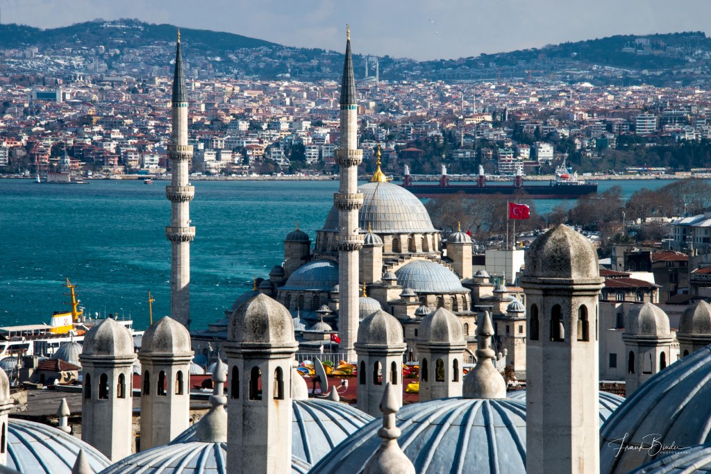
Long international flights leave ample time for ruminations and contemplations and my Nairobi to Istanbul flight last year accorded me seven hours to think about how I was going to soak in and appreciate 2500 years of history in a 3 ½ day photographic journey to what is undisputedly one of the world’s great cities.…
-
To The Omo I go go
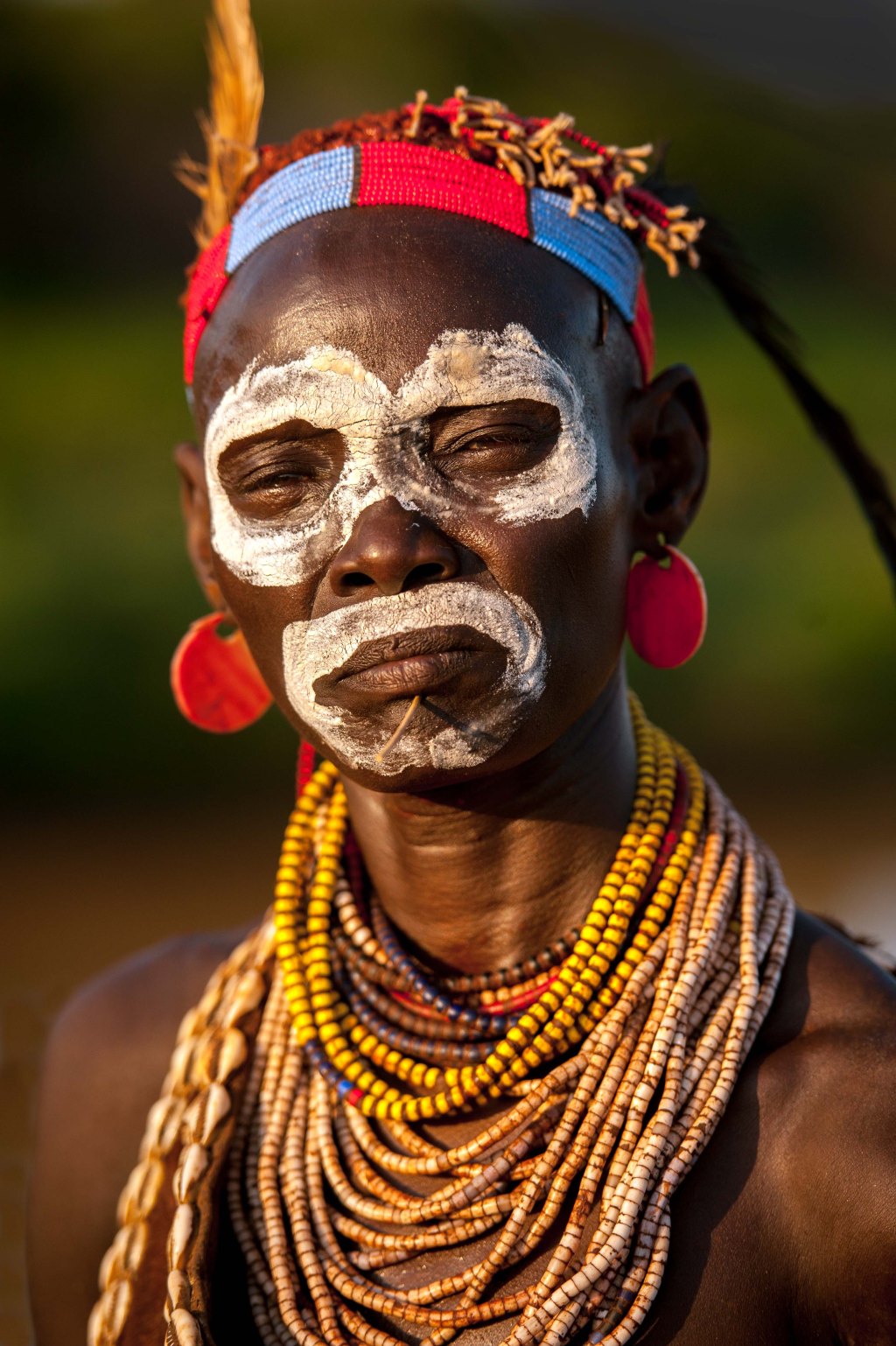
Ethiopia is such a remarkable country….a land of astonishing physical beauty, the only place on Earth with the spectacular Gelada baboon, a country where our earliest ancestors roamed, a place with ties to King Solomon and events in the Old Testament, and home to some of the most colorful ancient tribes on Earth. Lucy, one…
-
Bleeding Hearts
During my recent photographic journey to Ethiopia (with intrepid African Photographer Piper McKay), our small band of photographers climbed into Simien National Park which contains Ethiopia’s highest peak, Ras Dejen at 15,000 ft. Over millions of years the area’s plateaus have eroded to form precipitous cliffs and deep gorges of exceptional natural beauty. While we…
-
I Ain’t No Queen of Sheba
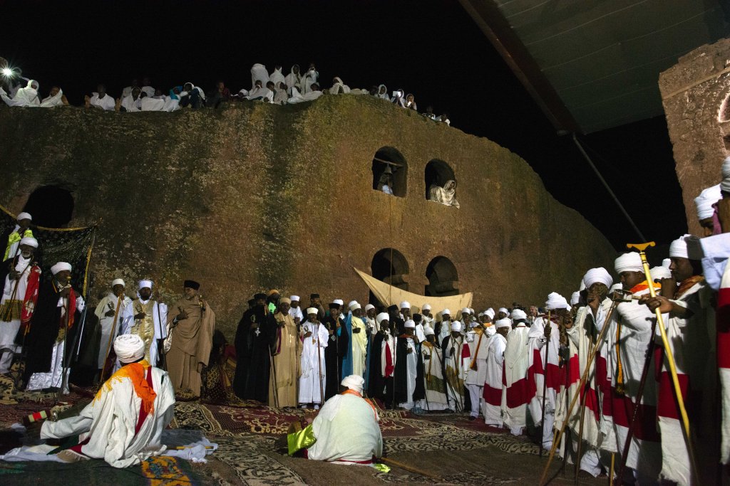
“Baby, you know I ain’t no Queen of Sheba” (Thing called Love; Bonnie Raitt). I didn’t go to Ethiopia to discover Sheba but rather to photograph ancient religious ceremonies, unique Gelada baboons and native indigenous tribes. But after engaging our guide Danny, with rudimentary questions about Ethiopia’s history, I was sucked into the quasi-historical…
-
Utah’s National Parks
To quote Ken Burns…..National Parks are the country’s best idea. The breadth of the country’s national park experience varies from the flat swampy bird filled Everglades NP to the ice fields of Glacier NP to the spectacular cliffs and spires of Grand Canyon NP and everything in between. If you’re into canyons and rock formations, southern…
-
Major Taylor
Marshall Walter “Major” Taylor (26 November 1878 – 21 June 1932) was an American cyclist who won the world 1 mile (1.6 km) track cycling championship in 1899 after setting numerous world records and overcoming racial discrimination. Taylor was the first African-American cyclist to achieve the level of world champion and only the second black man to win a world championship…
-
Death Valley – A Heat Tourist Destination
During my recent January visit to Death Valley I observed to a local that very few visitors were in the park and that I found this surprising given the moderate winter temperatures (daytime in the 60’s and 70’s). I ventured that summer would be a terrible time to visit because of the well-known record high…
-
Eastern Sierras
Here’s a little quiz for you geography geeks….where is the highest and lowest point in the continental United States? Well amazingly, they’re within 100 miles of each other in eastern California. Mt. Whitney is the tallest mountain in the lower 48 states and of course, Death Valley is the lowest spot in the U.S. In…
-
Firenze
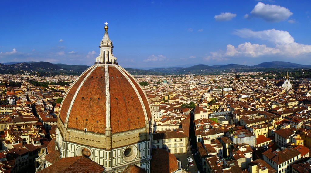
As the capital city of Tuscany, Florence was the center of medieval European trade and finance and is generally considered the birthplace of the Renaissance. Many of the world’s towering artistic giants walked Florentine streets and the city remains a magnet for art lovers the world over. The names are legendary…Michaelangelo, Leonardo, Dante, Lorenzo di Medici, Botticelli,…
-
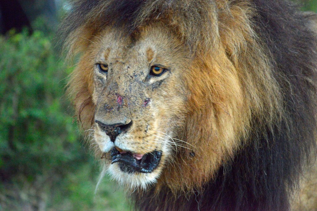
Africa – The Big Cats
If we play a word association game and I say…..Africa!…. many of you will say…… Lions! And I would say Bingo! The King of the Jungle resides on the plains of Africa and I can tell you it’s a thrill the first time you see a lion in its natural habitat and you realize exactly why you came to…
-
The Maasai
The Maasai are a semi-nomadic people inhabiting portions of southern Kenya and northern Tanzania. During my recent photographic trip to Kenya I visited several Maasai villages and had the opportunity to photograph traditional Maasai ceremonies as well as make candid portraits of these regal people. Maasai tradition call for boys to be circumcised at ages 12-13…
-
Amboseli
“But perhaps the most important lesson I learned is that there are no walls between humans and the elephants except those that we put up ourselves, and that until we allow not only elephants, but all living creatures their place in the sun, we can never be whole ourselves.” ― Lawrence Anthony, The Elephant Whisperer…
-
Amalfi Coast
“The day of judgment, for the Amalfi people who will go to heaven, will be a day like any other.” – Renato Fucini – The Amalfi Coast consists of 13 small towns along a rocky peninsula jutting out into the Mediterranean Sea just south of Naples, Italy. Most of these towns are situated in ravines formed…
-
Tuscany
“Italy, and the spring and first love all together should suffice to make the gloomiest person happy.” —Bertrand Russell – Italy…..a land of spectacular contrasts!……the Alps and the rolling hills of Tuscany; the Borgia’s 30 year reign of murder, debauchery and treason and the legendary artistic talent of Michelangelo, Leonardo, Dante and Cher (just wanted…
-
Subscribe
Subscribed
Already have a WordPress.com account? Log in now.
